The desert glossary, explained from Foum Zguid
By the Desert Foum Zguid team · Updated 11 August 2026
Erg, reg, sebkha, chergui: the desert has its own vocabulary, and knowing it changes how you see the place. Here are the words our travellers ask about most, explained simply by people who live here. Every term has its own anchor: other pages on this site point to this glossary whenever a word needs explaining.
Reading the landscape
Erg
A sea of dunes. The word is Arabic and names the great sand fields that the wind piles up and reshapes without rest. Despite the postcard image, ergs cover only a small part of the Sahara. Morocco has two large ones: Erg Chebbi near Merzouga, and Erg Chigaga, ours, which runs some forty kilometres.
Reg
A plain of wind-polished stones on hardened ground. This is the Sahara's true face: most of the desert is reg, not sand. On the Chigaga track you drive over reg long before you touch a dune. Nomads read the tracks on it like an open book.
Hamada
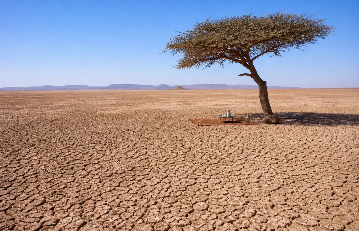
A bare rocky plateau, swept by wind that has carried the sand away. The Draa hamada between Foum Zguid and the dunes is a lunar country of dark slabs and flat horizons. You pass lone acacia trees and, with luck, a gazelle in the early morning.
Sebkha
A clay and salt depression, the floor of an old lake that now fills only after heavy rain. The most spectacular one in our region is Lake Iriqui: 60 kilometres of white plain between Jbel Bani and the dunes. When dry, it drives like a billiard table.
Oued
A river that does not flow all year. Most of the time an oued is a dry bed of pebbles; after a storm it can fill within minutes. Foum Zguid owes its name to one: the "foum", the mouth, is the gap where the Zguid river breaks through the mountain.
Regions and landmarks
Jbel Bani
The long black mountain barring the northern horizon of Foum Zguid. This low range runs for hundreds of kilometres along the southern edge of the Anti-Atlas, a wall between the oases and the desert. Its rocks carry engravings thousands of years old, and the whole territory now forms the Jbel Bani Geopark.
Anti-Atlas
Morocco's southernmost mountain chain, about 800 kilometres from the Atlantic coast to the edge of the Tafilalet, topped by Jbel Sirwa at 3,304 metres. It is an old, worn mountain with villages tucked among almond trees. The road from Marrakech or Agadir to Foum Zguid crosses it.
Draa valley
The Draa is Morocco's longest river: 1,100 kilometres from the High Atlas to the Atlantic, most of it flowing under the sand. Its valley between Agdz and M'hamid strings palm groves and fortified villages along 200 kilometres. This is the river that once filled Lake Iriqui, before the Ouarzazate dam was built in the 1970s.
Tata province
Our province, south of the Anti-Atlas. A country of oases strung along dry rivers, among the least visited in Morocco. Summers are harsh, above 45 °C, and winters full of light. Foum Zguid is its eastern gate; the town of Tata, 1.5 h down the road, is its capital.
Taznakht
The crossroads where you leave the main road and drop south to Foum Zguid. The town is the capital of the Ouaouzguite carpet, woven in wool by women from the Sirwa villages. If you buy one carpet in Morocco, buy it here in the cooperatives, not in a city bazaar.
Tizi n'Tichka
The pass that lifts the Marrakech-Ouarzazate road over the High Atlas at 2,260 metres. Count on two hours of bends, huge views and sometimes snow in midwinter. It is the unavoidable crossing, and the first great memory, of our trips from Marrakech.
The N12
The trans-Bani road: it links Tata to Rissani along the desert's edge through Foum Zguid and Zagora. Paved, quiet, beautiful. It is the favourite route of motorhomes and riders doing the southern Morocco loop, and many stop with us for a tour to the dunes.
Erg El Mhazil
The small erg closest to Foum Zguid, about an hour and a half down the track. Its dunes are more modest than Chigaga's, but the solitude is complete. It is our option for a first night on the sand when there is no time to reach the great erg.
Erg Lihoudi
The first dunes reached from M'hamid, some ten kilometres from the village. Many cheap tours sold as "a night in the desert" stop here. It is pretty, but it is not Chigaga: the camps are many and the dunes soon walked.
Erg Smar
A chain of dunes between M'hamid and Erg Chigaga on the eastern track. Camel caravans stage here on multi-day treks. From Foum Zguid you do not cross it: our track passes Lake Iriqui, on the other side of the great erg.
Oum Laalag oasis
A freshwater spring and a stand of tamarisk trees in open desert, east of Erg Chigaga. Nomads hold it sacred and caravans have rested here for as long as anyone remembers. Our three-day tours stop for lunch in its shade, feet in the cool sand.
Climate and atmosphere
Chergui
Morocco's east wind, hot and dry, a cousin of the sirocco. It is born beyond the Atlas, loses its moisture crossing the mountains and reaches the south loaded with dust. It blows mostly in summer, sometimes for a few days in spring. When it rises, you tie your scarf and wait: it always falls again.
The Saharan night
The desert changes skin at dusk. The temperature can drop fifteen degrees in a few hours, the silence becomes complete, and the sky switches on: at Chigaga, with no light bulb within 60 kilometres, the Milky Way is visible to the naked eye most of the year. That night is what people travel this far for.
Culture and daily life
Ait Atta
The great Amazigh confederation of Morocco's south-east. Born around the Saghro massif, it extended its herding routes into the Draa and Ziz valleys. The nomad families you meet around Chigaga often belong to it. Many of our guides are of this culture: the desert is their family home.
Kasbah and ksar
Two words of earthen architecture. A kasbah is one family's fortified house, with its four corner towers. A ksar (plural: ksour) is a whole fortified village, covered lanes included. The Draa valley lines up dozens of them; Ait Ben Haddou, on the Marrakech road, is the most famous in the country.
Palm grove
A cultivated oasis, organised in storeys: date palms make the shade, pomegranate and fig trees grow beneath them, and barley, alfalfa and henna take the ground floor. Foum Zguid's grove is best walked late in the day, when the light comes through the fronds.
Seguia
The irrigation channel that shares water through the palm grove, on water-turns settled between families generations ago. Following a seguia is the best way to visit an oasis: it always leads somewhere, and often to a conversation.
Cheche
The Saharan scarf: four to five metres of light cotton wound around head and face. Against sun, against blowing sand, against the evening chill. Our guides will show you how to tie it; it is the most useful purchase of the trip, well ahead of any hat.
Dromedary or camel?
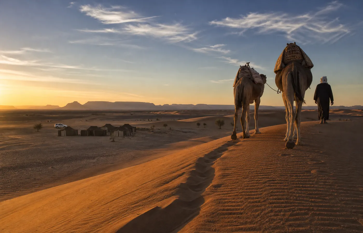
One hump: dromedary. Two humps: camel, and it lives in Central Asia. Every "camel" in Morocco is therefore a dromedary, though everyday speech mixes the two words, and we do too. The animal itself takes no offence: it carries, it walks, and it keeps its own counsel.
Desert tea
Chinese green tea, mint when there is some, plenty of sugar, and time. It is poured from high up to raise a foam, and drunk in several glasses, from strongest to sweetest. Refusing the first glass is hard; refusing the third, nearly impolite. The ritual matters as much as the drink.
Souk
The weekly market, an institution in every southern town. Each town has its day; nomad families come in to sell and stock up. The one in Foum Zguid is still a true country souk: livestock, dates, spices, blacksmiths, and not a tourist trinket in sight.